Sign up to take part
Registered users can ask their own questions, contribute to discussions, and be part of the Community!
Registered users can ask their own questions, contribute to discussions, and be part of the Community!
Hi,
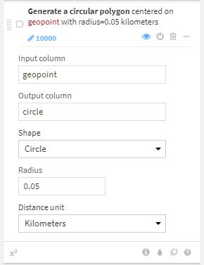
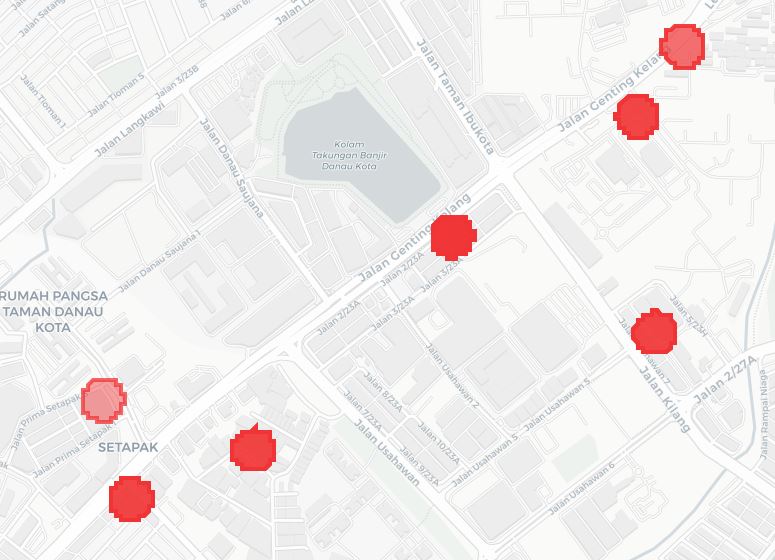
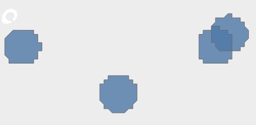
I'm attempting to draw a circular polygon of a 50meters radius using the geo point created from the latitude and longitude columns.
However, the output shape looks weird and edgy instead of a circle. May I know what are the possible issues here?
Thanks!
Hi @nkianhow,
Thanks for sharing. The polygon we build with the "Create area around a geopoint" processor is made of 120 edges, to be as close as possible to a circle. However the geometry is simplified in our visualisation tool for memory purpose, and that's where the issue comes from: the geometry you observe on the map is an over simplified version of your real geometry. I'll add it to our backlog.
I hope it was helpful.
Clémence
Hi @ClemenceB ,
Thank you for the explanation. Will keep that in mind when utilizing the visualization tool.
I tried viewing it in Tableau and the polygons appears to be the same. It seem that the output polygons are not a full circle. What's the limitation when using the "Create area around a geopoint" processor in terms of the radius? I'm attempting to create circles with the range of 40 - 60m.
Kian How
